A Sail of Two Idiots (23 page)
Read A Sail of Two Idiots Online
Authors: Renee Petrillo
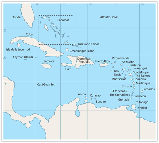
Turks and CaicosâDefinite Possibilities
O
n the morning of our 53-mile final hop from Mayaguana Island southeast across the Caicos Passage (over 12,000 feet deep!) to the Turks and Caicos, I had to swerve around a cow. In the ocean. A dead cow, with its hooves sticking out of the water. I thought it was a log, but as it passed I stared at the receding roadkill and thought, now there's something you don't see every day.
We were headed to Providenciales (Provo, as the locals call it), an island on the western edge of the Caicos island group. Most boaters head south of the island because in late spring, when they usually head to the Turks and Caicos, the trade winds are still blowing from the northeast. Guidebooks tell them to go to the south of the island to anchor in Sapodilla Bay, a dry, dusty place in the middle of nowhere. Then when they continue to sail the southern route, they run into shallow waters and an area like that boulder field we tackled between Royal Island and Allen's Cay in the Bahamas. Most boaters who see the Turks and Caicos this way hate it. We didn't follow that advice.
Astrid and Paul, on trawler
Horizons
âthe people who called us
Jacumba
-At-Anchorâhighly recommended Grace Bay, on the northeast coast of Provo. Because we left later in the season and the winds were coming from the southeast, going the northern route was safer and prettier, so that's what we did. You'll note that trade winds throughout the Caribbean tend to come from the northeast at a brisk 15 to 25 mph during the winter and shift to the southeast at a flaky 0 to 15 mph during the summer.
LESSON 63: DON'T ALWAYS GO BY THE BOOK
(literally) Most people cruising in the area use Bruce Van Sant's
Thornless Path to Windward
as their “bible” and refuse to deviate from it regardless of conditions. How unimaginative. We had the right winds for sailing the northern route and were able to experience the better part of the islands because we were willing to try something else. The books are guidesânot law. You should have seen other boaters' faces when we told them we had taken the northern route. Were we crazy?! Even my first mate was caught in this group-think. Michael would refuse to drop anchor if there wasn't an anchor symbol on the chart/chartplotter in the spot I was taking us. The anchor signs are recommendations; they are not the only places you can anchorâjeez.
We got 8 miles off the Provo coast and picked up an Internet signal. Can you believe it? I sent an e-mail to Astrid and Paul, who were in the marina there, telling them we were just a couple hours out.
Two hours later, while we were winding our way through the buoys toward the marina, trying not to go outside the lines and hit the coral, we were hailed by Astrid asking if that was our “stick” coming in. She and Paul had talked the customs lady into waiting for us (it was about 4:30 p.m. by that time), and they were standing at the marina dock waiting to catch our lines. How civilized!
I saw the dock and about had a heart attack when I realized that I'd have to turn and squeeze between two boatsâone a huge multi-million dollar yacht, the other a small fishing boat. Aaack! Although we had stopped at Mayaguana Island, we had not slept well. During the final passage, the waves had continued to pound us from the south, punishing us not so much by their size but by their short distance apart. Oy, the banging. We felt as though we had been under way for almost 32 hours. We were exhausted.
I managed to get to the dock without looking stupid or hitting anything, but my hands were still shaking as I filled out the customs paperwork (there weren't too many countries that had customs agents board your boat, but Provo was an exception). I never did get used to dockingâwe just didn't do it enough.
Once we were done, we moved off the dock (aaagh again) and anchored off the beautiful, long beach in Grace Bayâall by ourselves. Paradise. Welcome to the Caribbean.
I could kayak to shore and run the 12-mile beach every morning. Michael could snorkel right off the back of the boat. We had constant winds of about 20 knots and sun just about every day (with intermittent showers instead of never-ending rains). Our wind generator and solar panels were keeping pace with our energy usage, so we never had to run the engines. We could dinghy to a beach path that led to a great grocery store that even carried Diet Dr. Pepper! We could also dinghy to the Turtle Bay Marina and visit several nice restaurants. Snorkeling just outside the marina rewarded us with the most plentiful fish and colorful coral we would ever see again. It had everything we neededâexcept hurricane protection.
As we did on all inhabited islands with roads, we rented a car for the day so we could sightsee. We didn't run across anything of note during our excursion, but we did check out Sopadilla Bay, to the south, and were glad we had gone north. Of course, we reprovisioned with the cheaper (and more plentiful) groceries there and got fuel as well.
For about a week another catamaran was anchored next to us. During that week their boat was hit by lightning, which fried their electronics. The bolt bounced off them and knocked out our four-month-old Garmin GPS antenna. That's how close these guys were anchored to usâoff a 12-mile beach â¦
LESSON 64: BIRDS OF A FEATHER
â¦
Some boaters like to stick together ⦠really close together. Many boaters find safety in numbers. I cannot tell you how often we anchored somewhere off the beaten path only to watch another boat turn toward us. Then, because the holding was obviously good in our spot, they would plop right on top of us. (Americans tend to want the most space; the French the least.)
Garmin sent us another antenna within two days, no questions asked. That had to be the most effortless repair ever. The other boat didn't have it so easy, especially when it hit the reef outside the marina. I hate it when that happens.
We could have remained anchored in our spot forever. We didn't have any plans to visit the other islands that make up this country. Some were uninhabited; others were residential and we had heard that visitors weren't exactly welcomed on them with open arms. More worrisome was the fact that the rest of the islands were surrounded by reef (particularly tricky if you were coming in from the north), so getting in and out would be dicey. It wasn't worth it. We figured if we ever moved to Provo or visited again, we could sightsee via motorboat for a day.
Too soon it was the end of July and our two-month visas were about to expire. Of course we could renew them, but we decided instead to use their expiration as the kick in the pants we needed to get to safer surroundings in hurricane terms. We were already two months into the official hurricane season.
Horizons
was long gone. It was time for us to go, too.
Ooooookaaaaaay. Head hanging ⦠foot dragging ⦠lower lip out here. I guess we should leave. Mope. We set our course for the Dominican Republic, reluctantly picked up anchor, and headed to East Caicos, a 53-mile hop, to anchor overnight. We had to sail north around North Caicos, then east, and then southeast, encountering strange gusty winds coming from all over. Once at East Caicos, we aimed for a circular reef, inside which we would drop anchor.
Once we got to where I had plotted our entrance to the reef, all I saw was breaking water. That didn't look right. Then I noticed that the chartplotter called the area a “fake cut,” and I realized that I had chosen the wrong entrance. Oops! Because I had learned about looking up from my chartplotter in Miami (LESSON 19, yes it was me), my mistake did not turn into a disaster. After a quick check of the charts, we went through the correct cut and dropped anchor. We were chagrined to discover that the bottom was coral (sorry!) but relieved when the new Bulwagga anchor grabbed.
To be surrounded by nothing but reefâwow! We were mesmerized (and somewhat terrorized) all night by the waves crashing around usâso mesmerized, in
fact, that we got no sleep. The anchor held all night despite the high winds; unfortunately, it also bent â¦
As the sun came up, so did our sails, and we used our chartplotter track to get us back out of the reef (we couldn't see the coral in the low-angled light) and headed for Grand Turk, about 41 miles southeast. At one point during our sail, I brought us alongside a benign storm cell just to see how close I could get to it without being sucked in. I had seen the storm on the radar and initially tried to avoid it, but I'd gotten pretty good at reading these types of cells over the past few months. On radar, the black mass didn't look that dense. Once we could see the storm, the direction of the rain (straight down) indicated that there was no wind, and the fact that the rain wasn't bouncing off the ocean also suggested light winds (if any). There was no thunder either, so I felt like teasing it a bit. We were able to reach out over the port side of the boat and get our fingertips wet, while getting nary a drop of rain on the rest of us or on
Jacumba
. Nifty.
Brisk winds gave us a nice five-hour sail, but once we arrived at the South Dock anchorage, we had trouble finding a place to drop anchor. On one side was a freighter, on the other side a cruise ship, and in the middle a lot of private moorings for boats catering to the cruise-ship passengers. Tourists were frolicking in the water in the limited places we could plop. We motored up the shore but couldn't find an alternative, so we motored back and squeezed ourselves into a space.
While the ship was in, people were everywhere, stores were open, touring dinghies motored around usâit was madness. As soon as the ship left, the harbor died. No bars, no restaurants, nothing. All closed. Weird.
Since we had time to explore, we decided to walk to the historic downtown area of Cockburn Town. We're avid hikers, but the island was bigger than we thought and we got tired walking. It was hot! We decided we weren't that curious about our destination and ended up flagging down a cab to take us back to the boat. Thanks to the freighter and the Texaco refinery, we didn't get a lot of sleep on that stopover and were happy to leave early the next morning.
Here we hit a little slice of heaven before our final stop in Pooperon. Just 19 miles (three hours) southwest of Grand Turk, we stopped at Big Sand Cay (a Turks and Caicos national park) and didn't want to pick up anchor again. We were going to stop just for the day and then take off that night for a 90-mile overnighter to the Dominican Republic, on the island of Hispaniola. Change of plans! We knew when to stop and smell the roses (and sleep)âLESSON 61. We thoroughly enjoyed the
beauty, the peace, and the quiet. There were four other boats there, all with Canadian flags, but they were quiet too.
Sure it was just another spit of white sand, but we could not have too many of those. After two days (the last three with empty water tanksâwe were drinking what was in the freezer), we needed to get moving again. Ooooookaaaaaay.
Although we could have done the upcoming sail during the day, our guidebooks warned us of tricky, gusty trade winds after 8 a.m., so another night sail it would be. We planned to leave Big Sand Cay around 5 p.m.

 Before we left, we discovered that a couple of navigation lights on the top of the mast weren't working, so it was back up the mast for Michael.